
Natural disasters are getting more frequent and more severe. Floods, hurricanes, wildfires, and earthquakes put millions of people at risk every year. The good news is that technology is getting better at fighting back. On July 7, 2026, the United Nations released a new report on AI and early warning systems. Alongside it, Google shared how it is putting AI to work for disaster resilience. The idea is simple: use smart technology to predict disasters, warn people in time, and respond faster when the worst happens. Here is a clear breakdown of how Google AI for disaster resilience actually works, and why it matters for all of us.
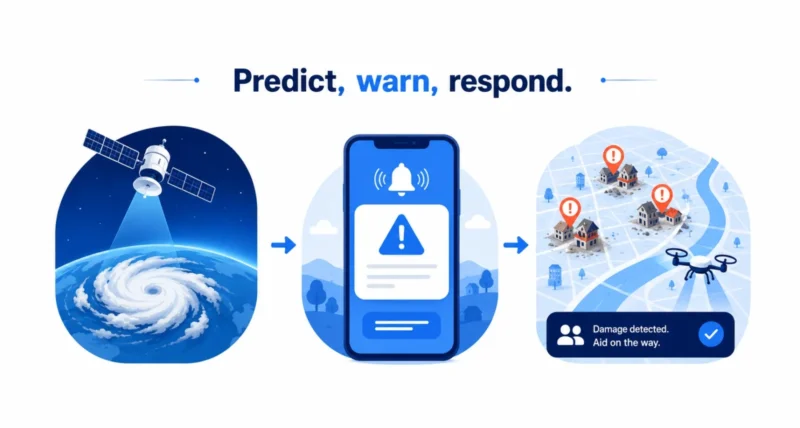
| In Short Google is using AI to help the world handle natural disasters in three ways. First, it predicts floods, hurricanes, and wildfires early, giving people time to prepare. Second, it sends fast, trustworthy alerts through Search, Maps, and Android phones during a crisis. Third, after a disaster, it uses satellite images to spot damaged buildings so aid can reach people faster. Much of this happens with partners like the United Nations, and it is already helping billions of people around the world. |
What Is This All About?
Here is the background in plain terms. The United Nations runs an initiative called Early Warnings for All. Its goal is to make sure every person on Earth is protected by an early warning system. Google has supported it since 2022. Alongside a fresh UN report on using AI for early warnings, Google shared how its own AI tools fit in. They help governments and aid groups prepare for and respond to disasters. The bigger mission is a world where no one is caught off guard by a natural disaster. You can read more about the Early Warnings for All initiative on the UN’s site.
The 3 Ways Google Uses AI for Disasters
Google’s work falls into three simple stages that match the timeline of any disaster: before, during, and after. Here is the quick overview.
| Stage | What Google’s AI Does |
| Before a disaster | Predicts floods, hurricanes, and wildfires early so people can prepare |
| During a disaster | Sends fast, reliable alerts through Search, Maps, and Android phones |
| After a disaster | Uses satellite images to spot damage and speed up aid |
Let us walk through each one.

Before a Disaster: Predicting Floods, Storms, and Fires
The best way to survive a disaster is to see it coming, and Google’s AI is getting remarkably good at that. For hurricanes, Google built a forecasting model called WeatherNext. During the 2025 hurricane season, the US National Hurricane Center used it on Hurricane Melissa. It predicted the storm’s Jamaica landfall a full five days ahead, giving officials time to warn the public. You can learn more about WeatherNext from Google DeepMind.
For floods, Google’s forecasts now cover 2 billion people across more than 150 countries through a free tool called Flood Hub. In Nigeria, the UN and the charity GiveDirectly used these forecasts to act early. They even sent families cash before floods hit, so people could evacuate and buy supplies like sandbags.
For wildfires, Google tracks fire boundaries in Search and Maps across 34 countries. It also helped build FireSat, a new fleet of fire-spotting satellites. In fact, three new FireSat satellites launched the very same day this news came out.
During a Disaster: Sending Life-Saving Alerts
When a disaster is unfolding, getting the right information fast can save your life. In 2025 alone, Google connected people with crisis information more than 10 million times a day, on average.
One tool is Public Alerts. When an official weather service or government issues a warning, Google surfaces it right in Search, Maps, and as Android phone notifications. These alerts now pull from authorities in over 90 countries, so people see trusted warnings instead of rumors.
There is also a clever earthquake system. Google turns everyday Android phones into tiny motion sensors that can detect shaking. When strong earthquakes struck Venezuela last month, the system alerted millions of people beyond the quake’s center. That gave them precious seconds to take cover before the shaking arrived.
After a Disaster: Speeding Up the Response
Once a disaster passes, the race is on to get help to the people who need it. This is where satellite images and AI really shine. Google worked with the UN Satellite Centre on a tool that scans satellite photos to spot damaged buildings automatically. What used to take human experts weeks now takes a fraction of the time, and the tool has already been used 11 times for real disasters.
After Hurricane Melissa hit Jamaica in late 2025, it assessed damage to more than 385,000 buildings to guide the recovery. After floods in Colombia in early 2026, it helped map the damage for UN agencies and the national government. Google has bundled these mapping tools into a collection called Google Earth AI.
| Real Example | How AI Helped |
| Hurricane Melissa, Jamaica (2025) | Predicted 5 days early; then scored damage on 385,000+ buildings |
| Floods in Nigeria (2025) | Early forecasts triggered cash aid before the water arrived |
| Earthquakes in Venezuela (2026) | Android phones warned millions seconds before the shaking |
| Floods in Colombia (2026) | AI mapped damaged areas to guide the relief effort |
Why This Matters
It is easy to think of AI as just chatbots and photo filters. But this is AI doing something deeply useful: helping to keep people alive. Every extra hour of warning means more families can reach safety. Every faster damage map means aid arrives sooner. And because these tools work hand in hand with the UN, governments, and charities, they reach the people who need them most, including communities that are often overlooked. It is a hopeful reminder that the tech in our pockets can take on the planet’s hardest problems. You can see that same spirit in our look at floating solar panels.
Google AI for disaster resilience is a strong example of technology working quietly in the background to protect people. By predicting disasters earlier, warning people faster, and speeding up the response, these tools are already making a real difference across the globe.
As the technology improves and reaches more countries, the goal starts to feel within reach: a world where no one is caught off guard by a natural disaster.
Frequently Asked Questions
How does Google use AI in natural disasters?
Google uses AI in three main ways. It predicts disasters like floods and hurricanes early. It sends fast alerts during a crisis through Search, Maps, and Android phones. And afterward, it analyzes satellite images to find damage and speed up aid.
What is Google Flood Hub?
Flood Hub is a free Google tool that shows AI-based river flood forecasts. It now covers about 2 billion people across more than 150 countries, helping governments, aid groups, and families prepare before floods hit.
How do Android earthquake alerts work?
Google uses the motion sensors already inside Android phones to detect the shaking of an earthquake. When many phones detect it at once, the system can warn people farther away, giving them a few seconds to take cover before the shaking reaches them.
What is WeatherNext?
WeatherNext is a Google weather-forecasting model built with AI. The US National Hurricane Center used it in 2025 to predict Hurricane Melissa’s landfall in Jamaica five days in advance, giving officials time to warn people.
Can I get Google’s disaster alerts?
Often, yes. Public Alerts can appear in Google Search, Google Maps, and as notifications on Android phones when your local authorities issue warnings. Availability depends on whether those authorities publish alerts in your country.
Is this available around the world?
Much of it already is. Flood forecasts reach more than 150 countries, public alerts draw from over 90 countries, and wildfire tracking covers 34 countries. Google says it is working with partners to keep expanding coverage.

